Category:Armier Bay
Jump to navigation
Jump to search
| Object location | | View all coordinates using: OpenStreetMap |
|---|
bay  | |||||
| Upload media | |||||
| Instance of | |||||
|---|---|---|---|---|---|
| Location |
| ||||
 | |||||
Subcategories
This category has the following 2 subcategories, out of 2 total.
C
- Crivelli Redoubt (4 F)
L
- Louvier Entrenchment (3 F)
Media in category "Armier Bay"
The following 24 files are in this category, out of 24 total.
-
 Armier Sunser.jpg 1,080 × 608; 64 KB
-
-
-
 Malta - Mellieha - Triq Dahlet ix-Xmajjar - Armier Tower (Triq Ramlet il-Qortin) 01 ies.jpg 5,616 × 3,744; 9.26 MB
-
 Malta - Mellieha - Triq ir-Ramla tat-Torri l-Abjad + Armier Tower 01 ies.jpg 5,616 × 3,744; 6.69 MB
-
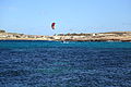
Malta - Mellieha - Triq ir-Ramla tat-Torri l-Abjad - Kitesurfing (Triq Ramlet il-Qortin) 01 (0) ies.webm 21 s, 1,920 × 1,080; 14.31 MB
-

-
-
 Malta - Mellieha - Triq ir-Ramla tat-Torri l-Abjad - Kitesurfing 01 ies.jpg 5,616 × 3,744; 8.84 MB
-
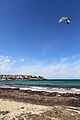
 Malta - Mellieha - Triq ir-Ramla tat-Torri l-Abjad - Kitesurfing 02 ies.jpg 3,744 × 5,616; 6.46 MB
-
 Malta - Mellieha - Triq ir-Ramla tat-Torri l-Abjad - Kitesurfing 03 ies.jpg 5,616 × 3,744; 11.26 MB
-
 Malta - Mellieha - Triq ir-Ramla tat-Torri l-Abjad - Kitesurfing 04 ies.jpg 3,744 × 5,616; 8.87 MB
-
 Malta - Mellieha - Triq ir-Ramla tat-Torri l-Abjad - Kitesurfing 05 ies.jpg 5,616 × 3,744; 10.57 MB
-
Malta - Mellieha - Triq ir-Ramla tat-Torri l-Abjad 01 (0) ies.ogv 25 s, 1,280 × 720; 74.18 MB
-
 Malta - Mellieha - Triq ir-Ramla tat-Torri l-Abjad 02 ies.jpg 5,616 × 3,744; 11.76 MB
-
 Malta - Mellieha - Triq ir-Ramla tat-Torri l-Abjad 03 ies.jpg 5,616 × 3,744; 10.98 MB
-
 Malta - Mellieha - Triq ir-Ramla tat-Torri l-Abjad 04 ies.jpg 5,616 × 3,744; 8.03 MB
-
 Malta - Mellieha - Triq ir-Ramla tat-Torri l-Abjad 12 ies.jpg 5,616 × 3,744; 12.92 MB
-
 Malta - Mellieha - Triq Ramlet il-Qortin 01 ies.jpg 5,616 × 3,744; 10.49 MB
-
 Malta - Mellieha - Triq Ramlet il-Qortin 03 ies.jpg 5,616 × 3,744; 9.12 MB
-
 Malta - Mellieha - Triq Ramlet il-Qortin 04 ies.jpg 5,616 × 3,744; 11.27 MB
-
 Malta - Mellieha - Triq Ramlet il-Qortin 05 ies.jpg 5,616 × 3,744; 9.6 MB
-
 Malta-Armier Bay-beach.JPG 3,264 × 2,448; 1.47 MB
-
 White Tower as seen from St. Agatha's Tower.JPG 3,072 × 2,304; 2.96 MB

_julesvernex2.jpg)
_julesvernex2.jpg)
_01_ies.jpg)

_01_ies.jpg)
_02_ies.jpg)


